
For this project, I sought to compare the land use of downtown Detroit of the past and present. Due to suburbanization, the construction patterns of Post-WW2 America, and De-Industrialization, Detroit (as well as many other cities) have been emptied out. I compared aerial imagery of Detroit today and in 1949, to determine how much land is occupied by parking lots, empty space, and highways.
The aerial imagery of 2021 Detroit comes from Google, and the 1949 imagery can be found here: http://gigapan.com/gigapans/147450
First, using QGIS, I georeferenced a portion of the 1949 imagery with that of 2021 to fit into the WGS84 coordinate system. After that I drew shapefiles representing different land uses on the imagery. Because of this method, take the data given in this study to be estimation rather than hard fact. With these shapefiles I calculated the total area used by each type of land use for each year. The results I found were quite staggering.
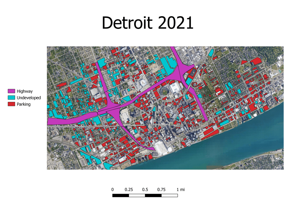
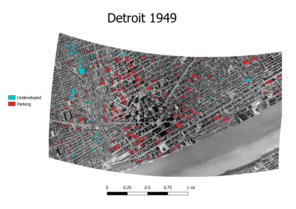
Just from a quick glance, you can see that much more of modern Detroit is covered with parking and empty space, with massive amounts of space being used for freeways that didn’t exist in 1949. The data backs this up quite well.
In 1949, of the 8,843,020 square meters surveyed, 471,186 m2 were covered by parking and undeveloped land. That accounts for 5.3% of the total area. For 2021, of the 12,290,000 m2 surveyed, 3,235,860 m2 was parking, undeveloped, and highway. That accounts for 26% of the total area.
The clear observation is that Detroit is much more empty now than it once was, and that much of the city is intentionally designed for suburban commuters than the actual residents of the city. There are many ways this can be observed, for example in 1949 Tigers Stadium is mostly surrounded by homes and businesses, while 2021 Comerica Park is completely surrounded by parking and highway.
