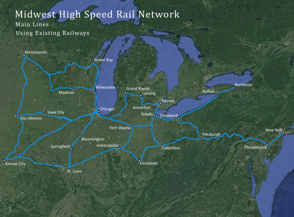
Here is an idea for a high speed rail system covering the American Midwest. The idea was to have main lines service major cities and use existing railways. The railway data for this project was obtained from the National Map Gis Data: https://www.usgs.gov/core-science-systems/ngp/tnm-delivery/gis-data-download
First data was loaded into QGIS for each state. From there I removed the many unneeded railway lines. From that I brought the map into Illustrator where I traced the lines on a new layer, then added city symbols and labels. Here is the finished proposal map, using a WGS 84 projection.